Friday, December 22, 2006
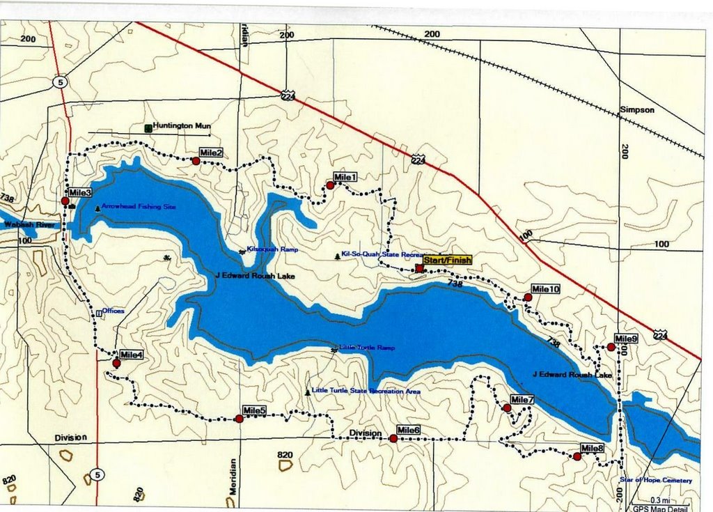
The HUFF Course Map
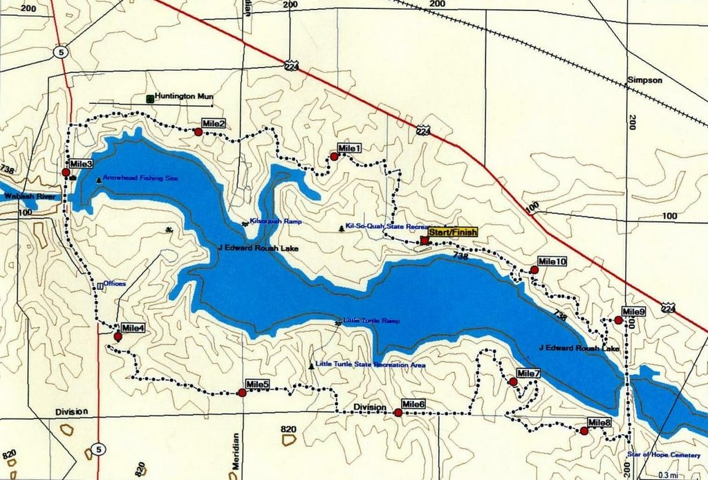
The HUFF 50K Course Map remains unchanged from last year.
Veterans of last year's run will remember that the course was changed on the south side as a result of the opening of the new shooting range and the DNR's experience with two major flooding episodes. The good news was that the change eliminated the chance to get your feet wet at a small stream crossing. And the new shooting range nearly eliminates noise from the gun enthusiasts. (Newbies: ask some veterans of the early HUFF years what the old shooting range could add to the flavor of the event.)
Unfortunately, there was a road section added to the course to bypass the shooting range.
Due to the requirements of some of the governmental funding sources, the shooting range was required to have a larger safety zone surrounding it. This meant that the then-existing trail was encroached by the new safety zone.
Once you bypass exit the road, however, you will reenter wooded trail that traverses some parts of the DNR property which were not part of the original HUFF course.
A particular thanks to Jerry Diehl and Bob Berger for laying out and measuring the course. Thanks also to Roush Lake Property Director Jeff Reed and his crew for trail maintenance and clearing. Several major downed trees have been cut up and removed from the trail in recent weeks. Ongoing trail maintenance kudos also need to go to the mountain bike crew of Huntington County who do ongoing trail clean-up throughout the year.
Jerry and Bob have placed small mile marker signs on the course for those who will be doing a training loop this weekend. Larger mile marker signs along with directional arrow signs, flourescent ribbons and other trail marking signs will be on the HUFF course for race day.
# posted by Mitch : 10:08 AM

![]()