Monday, September 19, 2005
New Course Changes Surveyed
We received the following question today about The HUFF course:
I have already registered for my first HUFF this year. I am very excited, and would like to do one of my training runs there. I live [about 90 miles away], and want to take a road trip to do a lap with my wife. Is the trail marked well enough, or is there a map that I could follow so that we do the same lap as the race lap?
The reply:
There have been a few changes on the HUFF course. Jerry Diehl, Bob Berger and myself were just out measuring the new areas this weekend. The DNR has worked to reroute trail so that it avoid areas which are prone to flooding even during moderately high water levels. HUFF runners should enjoy having a much easier time in keeping their feet dry during the race.
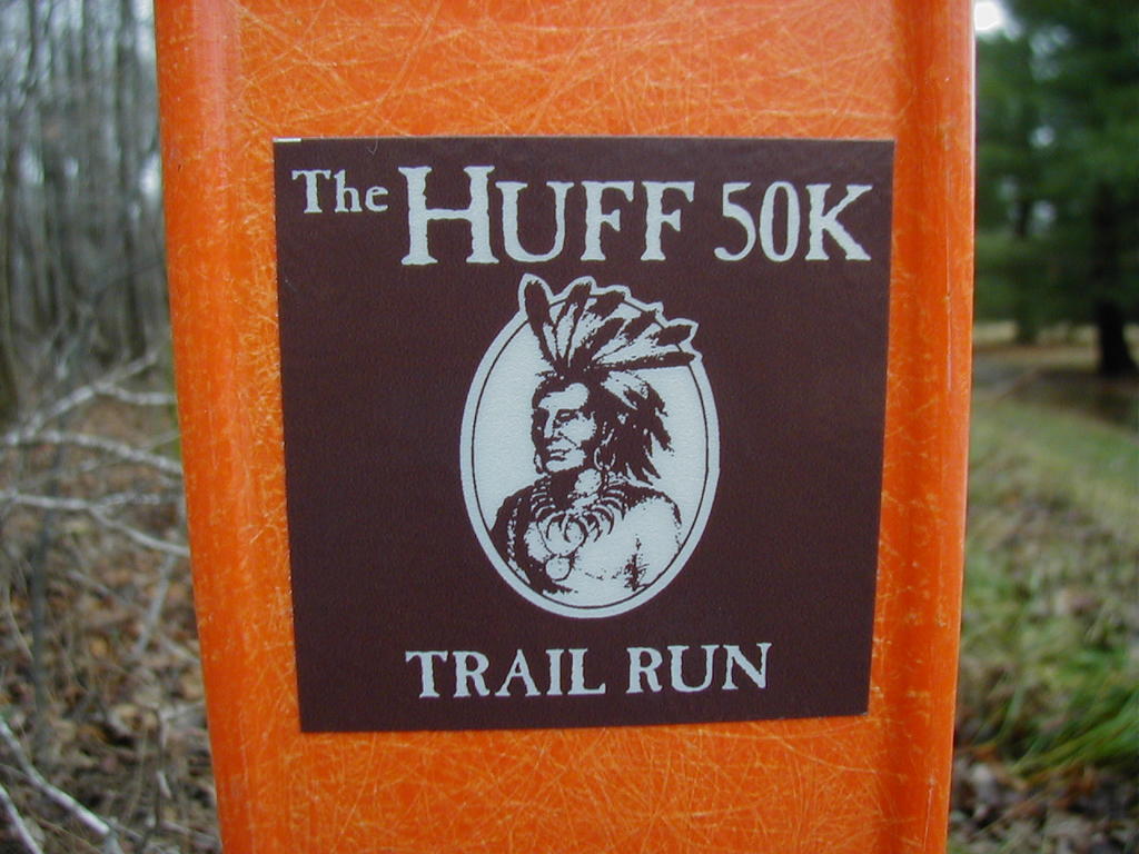
The HUFF course has been marked in the past with HUFF reflective markers (pictured here) on the orange trail posts. The DNR, in most cases, has moved the existing markers with the HUFF logo to show where the new trail goes.
So, if you start out your training run from the Kil-so-Quah campground and head west on the trail going nearest the access road you will not encounter any changes in the course until just before the Observation Mound near Highway 5. There you will encounter a very short trail change which keeps runners out of a low spot. It is a definite improvement and should not present any navigation problems.
You will then emerge at Highway 5; you will go south on Highway 5 across the dam; as soon as you pass the DNR office (the first office area is the Army Corps of Engineers) you will head east toward the little guard shack. Past the guard shack you will then enter the Kekionga trail right at the entrance to the campground. You will head south briefly, then generally east. Keep heading east past the Model Airplane field, cross the gravel drive leading to the Model Airplane Field and Archery range. The path is all the same until you emerge at the south boat ramp road. (This is an asphalt surface you will cross).
The Indiana DNR has just put in a new state-of-the-art shooting range on the south side of the reservoir. Due to the terms of their grant, they had to create a much larger 'safe' area around the range. This has meant that, on the south side, a short new trail has been created just after runners cross the boat ramp road. That trail leads runners out onto Division Road.
Once you are on the road, you will then have to run east on Division Road (perhaps we ought to call it ('Diversion Road') to a point just past the shooting range. You will then go north (toward the reservoir) on new trail. The DNR did a masterful job on this new section of trail and it certainly makes for a great running experience in the woods. This is a substantial new section. Runners will continue then to hook up with the winding area of tall trees before reaching Aid Station "B" (where the trail crosses Division Road). So follow the trail all the way to Simpson Road.
Runners will still complete the rest of the Kekionga Trail as they have in the past from Division Road to Simpson Road (200E). So, go north on Simpson Road, cross the bridge and go just a short distance before ducking back in the woods. Shortly after leaving Simpson Road runners will then encounter the second major change. This was done to keep runners out of a low area by the reservoir. This area was prone to flooding and muddiness. The trail now ducks into the woods before reaching the downhill that took one down to the low area. The new trail is a very beautiful run through the woods before it reconnects with what had been the old trail at the top of the hill that came up out of the lowland.
You then will keep heading west on the existing trail. There are some trails that diverge off the trail between the hill and Kil-so-Quah campground. As a general rule on this section, "When presented with a 'fork' in the road, take the path on the left."
There is a trail map at the DNR office on Highway 5. They have a supply of maps in a kiosk near the parking lot.
The weekend course survey data is going to be analyzed by Jerry Diehl. We will then make decisions on where there may be modifications needed to keep the trail distance as close as possible to the original distance of the Kekionga Trail as used for the race. The DNR was striving to keep the distance the same as the original trail.
Overall, I would say that the DNR has done a great job in creating new and interesting trail sections to replace those that have been crossed out. Except for the short Division Road segment - I think HUFF runners will be well-pleased with the results. It certainly removes some of the uncertainty in the event of high water.
An Email back today from our future 2005 HUFF finisher:
Thanks for the quick reply. I was not expecting such effort in the response!!! See you at the Huff!!!!
# posted by Mitch : 1:56 PM

Comments:
<< Home
The course will definitly be different. I ran one loop on Friday the 14th with the changes and I must say it will be more of a challenge. The new trail on the north is more challeging. The "diversion road" is just that long rolling hills on asphalt. I think the course is now close to 25% road. The trails are still great though. See you there.
# posted by  : 5:20 PM
: 5:20 PM
after running the new course on nov. 12th and 19th this year, and having run the huff for several years prior, i would say the new course is at least a mile to a mile and a half longer than the old. what use to take under two hours for me to complete a loop at a leisurely pace is now 2 hours and 15 minutes...watch out on the new trails for tiny stumps that may trip you up. i went down once and was tripped up a couple more times. good luck.
# posted by : 2:02 PM
: 2:02 PM
The trail for 2005 was marked this morning, November 20th.
Those who believe they have run what will be The HUFF course could not have known before today. Bob Berger and Jerry Diehl, the course measurement and design team have posted mile markers for the 2005 course this morning.
Some of the DNR changes have been included. However, none of the new section just west of Simpson Road will be included. It would have, indeed, added too much distance to the course.
The 2005 course will be 10.8 miles.
A new course map will be posted on HUFF 50K Trail Notes tomorrow. We will also be posting a description of the exact course at that time.
Note that the 1st loop of the run will be slightly shorter than 10.8 due to the road start.
Post a Comment
Those who believe they have run what will be The HUFF course could not have known before today. Bob Berger and Jerry Diehl, the course measurement and design team have posted mile markers for the 2005 course this morning.
Some of the DNR changes have been included. However, none of the new section just west of Simpson Road will be included. It would have, indeed, added too much distance to the course.
The 2005 course will be 10.8 miles.
A new course map will be posted on HUFF 50K Trail Notes tomorrow. We will also be posting a description of the exact course at that time.
Note that the 1st loop of the run will be slightly shorter than 10.8 due to the road start.

<< Home
![]()